|
|
 04-19-2009, 11:01 PM
|
#1
|
|
Senior Member
Join Date: Apr 2007
Location: WA (USA)
Posts: 429
|
TWOLOST: Northern California Trip Report
As noted in a different thread (here), I had made plans to take our Sportsmobile back to Fresno for a 20K mile checkup, to fix a few items, and to update a few others. I had originally planned to drive solo from Seattle to Fresno and back again without much sightseeing. Then as my plans progressed, I really wanted to spend a few days on the way back home enjoying the California coastline. This morphed into spending a couple more days wandering around in some redwood groves. Lastly, I wanted to see if I could scare up a Bigfoot while in the area. The overall trip budget ballooned from an original 6 days to 12 days. As it became apparent that I was going to have more fun on the way home than I was allowed to have by myself, my wife decided less than 24 hours before departure that she wanted to come too. Good call. This is now an official TWOLOST thread.
I had a loosely planned itinerary to start with - but here is what actually happened...

Fuel Consumption:

Map(s):
King Range, Lost Coast - 657kb PDF file
__________________
Cheers,
---Bruce--- (epic-exposure.com/albums/adventure/)
|

|

|
|
04-19-2009, 11:04 PM
|
#2
|
|
Senior Member
Join Date: Apr 2007
Location: WA (USA)
Posts: 429
|
Re: TWOLOST: Northern California Trip Report (in-progress...)
Date: April, 04
Notes:
----------------------------------------------------------------
We had originally planned to stay at the Lake Siskiyou Campground near Mount Shasta, CA as our halfway stopping point for the first day. As it turned out, I was still tinkering with the van until after 1:00pm in the evening and we had not even started driving yet. Once we finally got on the road, we drove as far as we could before dark - which just happened to be Sutherlin, OR. To simplify where we were going to stay, we just pulled into a Best Western (Hartford Lodge) and spent the evening there. The accommodations were pretty decent as it had just opened to the public the week before.
__________________
Cheers,
---Bruce--- (epic-exposure.com/albums/adventure/)
|
|
|
|
|
04-19-2009, 11:30 PM
|
#3
|
|
Senior Member
Join Date: Apr 2007
Location: WA (USA)
Posts: 429
|
Re: TWOLOST: Northern California Trip Report (in-progress...)
Date: April, 05
Notes:
----------------------------------------------------------------
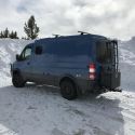
As we were three plus hours behind where we thought we would be today, we woke early and hit the road. Our destination was Lost Lake Campground, CA. This campground looked to be about 30 minutes north of Fresno, CA and the Sportsmobile factory based on our maps of the area. After a full day of driving we arrived at our destination around 6:15pm. This park has a day use area as well as a campground. The day use area closed at dusk (main access gate shuts to incoming traffic). There is an outgoing gate as well that remains open (with raised tire spikes for those that attempted to go in through the out door). I think we paid $5.00 at the main gate for an entry fee. We were supposed to pay an additional $18.00 to spend the night, but the campground host never made himself available to collect our money. There were less than a dozen campsites occupied at the time we stayed there. During the evening/early morning hours, there were a couple of these campsites that were pretty loud and obnoxious at times. As we chose to camp along the shoreline of a small lake, the nats were out in force too. We had to keep everything zipped up for the night as these bugs would easily gain entry to the inside of the van - zipping right past our existing screens. There were no hookups offered at this park.
Driving though the fog, early morning of day 2 (Interstate 5, southern Oregon):

Mount Shasta (driving south on I-5):

Lost Lake Park (in relation to the Sportsmobile West factory), 24.8 miles away:

In one of the more interesting things that happened today, I witnessed a heron stalking some fish right outside of our campsite (approx 100 yards away). This was an incredible experience. The heron would find a potential fishing spot and then stand perfectly still waiting for something to travel by. Like a bolt of lightning, the heron would strike with amazing speed and with precision accuracy. Below is a sequence of pictures I captured while this guy was fishing. During the strike on the below fish, I could hear the impact of the herons beak hit the fish like someone whacking a pumpkin with a 2x4. It was really vicious. The heron would spear the fish (impaling the fish over the herons beak), scrape the fish off of the beak, coil back and strike again (five more times). Then it was down the hatch.
Stalking (pay no attention, I am just a small tree... really):

Fish On:

Down the hatch:


All of the way down...

__________________
Cheers,
---Bruce--- (epic-exposure.com/albums/adventure/)
|
|
|
|
|
04-19-2009, 11:43 PM
|
#4
|
|
Senior Member
Join Date: Apr 2007
Location: WA (USA)
Posts: 429
|
Re: TWOLOST: Northern California Trip Report (in-progress...)
Date: April, 06 & 07 & 08
Notes:
----------------------------------------------------------------
Woke early and high tailed it out of the Lost Lake Campground in order to get into Fresno (Sportsmobile) around the time they opened. Upon our arrival at Sportsmobile, we quickly unpacked what we needed out of the van, went over the TODO list with Leo, and got a lift to our hotel (Holiday Inn) just five miles away. Our plan was to give Sportsmobile up to three full days to complete all of the work that they could during this time. If there were going to be any time overruns, we asked Sportsmobile to cancel any remaining work so that we could meet our projected schedule for our return trip home. Sportsmobile came through on all counts. We got all of the work done we had hoped to get done in the time allotted and our van was ready before closing time on the third day. Thanks Leo and the other folks at Sportsmobile that worked on our van!
__________________
Cheers,
---Bruce--- (epic-exposure.com/albums/adventure/)
|
|
|
|
|
04-19-2009, 11:57 PM
|
#5
|
|
Senior Member
Join Date: Apr 2007
Location: WA (USA)
Posts: 429
|
Re: TWOLOST: Northern California Trip Report (in-progress...)
Date: April, 08
Notes:
----------------------------------------------------------------
Shortly after lunch, we got the call that the work on our van was complete. Sportsmobile picked us up from our hotel and brought us back to the plant. Leo was there to give us the rundown on our completed TODO list. In short order we had our keys in our hands and we were off (racing the sun in order to find a campsite somewhere around the Sunset State Beach west of Watsonville, CA). After leaving Sportsmobile, we ended up driving a relatively short distance north on Hwy 99 to Hwy 152 and then straight west (pretty much) until we hit the Pacific Coast.
Note: Now if you want a great twisty motorcycle road, try Hwy 152 west of Hwy 101 and over Hecker Pass. Narrow and as twisted as a pile of Silly String for about 17 miles. If you have anything less than the remnants of a back tire and/or front brake pads once you finish this section, you are simply not enjoying the ride nearly enough. I put this on my "must return to do again on two wheels" list.
Turns out the campground at Sunset State Beach was already full. As such, we decided to drive a bit further north toward Santa Cruz to see about getting a campsite in the Henry Cowell Redwoods State Park. Success (just as it got dark). This was a no hookups campsite and there were less than five available spots left. The campers here were so quiet over night that it was actually eerie (this may have actually been the quietest state run campsite I have ever been to). A few gals were laughing and giggling around 9:30pm just a few sites down from us and then a booming voice cracked the night from a tent site and told them to shut up in no uncertain terms... and that was that. Not a peep from so much as a toad was heard after that.
Sunset State Beach:

Campsite at Henry Cowell Redwoods State Park:

__________________
Cheers,
---Bruce--- (epic-exposure.com/albums/adventure/)
|
|
|
|
|
04-20-2009, 01:07 AM
|
#6
|
|
Senior Member
Join Date: Apr 2007
Location: WA (USA)
Posts: 429
|
Re: TWOLOST: Northern California Trip Report (in-progress...)
Date: April, 09
Notes:
----------------------------------------------------------------
Relatively big driving day planned for today with about 275 miles of twists and turns. We headed up north, through San Francisco, over the Golden Gate Bridge, and then out to the coast on Hwy 1. We would drive up the coast until we hit our projected stopping point around Westport (which took us longer than expected).
San Francisco - city bustle:

Golden Gate Bridge:

Along Hwy 1

Random surf turf (actually, Big Basin Redwoods State Park, Waddell Beach):


California Turkey Vulture:

View from Muir Beach Overlook (Seascape Drive):

Seafood lunch at Bodega Bay. Teriyaki smoked salmon, dungeness crab, fresh bread and hot seafood chowder:


More Hwy 1:


Chasing the sun into the horizon:

The sun had already gone down and we were still driving into the night. Not far from our camping destination at Westport Beach RV Campground and just before they closed for the evening, we encountered three younger gals and their broke down rental car. They really needed a hand changing a flat tire. It was nearing pitch black, they did not have a flash light, they were on the shoulder of a narrow twisty road, and no other infrequent motorists were stopping to aide them. One of the gals flagged me down and told me their situation and there was no way we could just keep driving (even if that meant that we might not get to the campground before it closed). Time to put all of those lights on my roof rack to good use. The gals had done most of the work to get the spare out of the trunk, etc
and tried to jack the car off of the ground, but the car kept rolling off of the jack. It took a few minutes, but we worked through all of the problems and to their credit they were not afraid to jump right in and help. With the spare on, they were on their way - with hopefully not too long to go until the next town south (Fort Bragg). Where they were now was no place to be without adequate light. I would like to call out the dude who used an impact wrench to put the wheels on in the first place. Last time I checked, the torque specs for a front wheel drive compact car were not anywhere near 140ftlbs.

Everything worked out in the end as we made it to our campground destination before it closed by less than 15 minutes.
__________________
Cheers,
---Bruce--- (epic-exposure.com/albums/adventure/)
|
|
|
|
|
04-20-2009, 01:52 AM
|
#7
|
|
Senior Member
Join Date: Apr 2007
Location: WA (USA)
Posts: 429
|
Re: TWOLOST: Northern California Trip Report (in-progress...)
Date: April, 10
Notes:
----------------------------------------------------------------
Westport Beach RV Campground (full service campground):


Coastline along Hwy 1 (north of Fort Bragg):

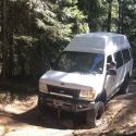
We found our way out to Usal Road (a primitive dirt road that runs right along the coast). Thanks to the members of this forum who pointed this out. It was a great drive and we had the place to ourselves for the most part. We located this obscure road with a little help from our GPS and by the hand painted "USAL" in the road with associated arrow. We were fortunate enough not to meet any oncoming traffic during our drive out and back to/from Usal Beach (7 miles or so each way). Once we arrived, we saw a couple other folks tent camping out of their cars and one stray pickup truck. We had a picnic lunch out on the beach and then retreated back into the hills and on our way to our overnight camping destination in the Standish-Hickey State Park (Rock Creek Campground). Even though Usal Road continues further north and would eventually lead to Shelter Cove we decided (based on advice from members here) that we would not risk our vans paint job in order to bushwack our way any further. We encountered no issues with Usal Road from Hwy 1 to Usal Beach.
Usal Road (map), approx 7.1 miles off road to primitive Usal Beach:

Usal Road (just above Usal Beach):

Usal Beach (below)

Usal Beach (rules and regs)

Entering the Usal Beach primitive campground:

Usal Road (primitive, narrow, steep, winding):


We stayed in the Rock Creek Campground overnight (no hookups in this campground). The campground was mostly empty (but our campsite was very near to the main highway, Hwy 101). As we do the majority of our exploring during the day and we just use these campgrounds to camp overnight, we really dont get out and see much once we reach our overnight destination. This was no exception. All of the kids we encountered (20+ years of age) were very friendly. There were a few older folks (40+) that were a little more suspect. In any case, if you are partial to the aroma of burning hemp this campground might just work for you.
Standish-Hickey State Park Campground (just north of Leggett, CA on Hwy 101):


__________________
Cheers,
---Bruce--- (epic-exposure.com/albums/adventure/)
|
|
|
|
|
04-20-2009, 02:28 AM
|
#8
|
|
Senior Member
Join Date: Apr 2007
Location: WA (USA)
Posts: 429
|
Re: TWOLOST: Northern California Trip Report (in-progress...)
Date: April, 11
Notes:
----------------------------------------------------------------
Plan for the day was to run north up Hwy 101 to the Avenue of the Giants, follow the Avenue of the Giants for most of its length, and then backtrack down Hwy 101 to Redway, Briceland, and finally Shelter Cove.
New bridge construction on Hwy 101:

The Legend... along Hwy 101 (shop of chainsaw woodwork):


Redwood Groves along Avenue of the Giants Hwy:


Ranch house at Needle Rock (steep, narrow, primitive road gets you here):

Briceland Thorn Road (primitive):

Seals at Shelter Cove:

When I thought that I was going solo, I had just planned to stay at one of the campgrounds near Shelter Cove. Well, my wife really did a great job of hanging on during the steep off-road ascents and descents we had been doing over the past two days. For her courage and for her patience, I popped for a hotel once we reached Shelter Cove. We headed for the hotel right on the water (Ocean Front Inn). We were able to get one of the rooms on the top floor, we then got all cleaned up, and I then treated us to a nice dinner in the hotel's restaurant. In the restaurant, we even scored the primo table right in front of two large picture windows overlooking the ocean - even with no reservations on a Saturday evening. This was just dumb luck
your mileage may vary. The hotel was $125.00 for the night and a nice meal for both of us was less than $60.00. Both the food and the service were very good.
Ocean Front Inn at Shelter Cove:

My wife's macro work along the way today:


__________________
Cheers,
---Bruce--- (epic-exposure.com/albums/adventure/)
|
|
|
|
|
04-20-2009, 02:35 AM
|
#9
|
|
Senior Member
Join Date: Apr 2007
Location: WA (USA)
Posts: 429
|
Re: TWOLOST: Northern California Trip Report (in-progress...)
More coming soon... must get sleep now.
Thanks,
---TWOLOST---  
__________________
Cheers,
---Bruce--- (epic-exposure.com/albums/adventure/)
|
|
|
|
|
04-20-2009, 06:33 AM
|
#10
|
|
Senior Member
Join Date: Jun 2007
Location: Helena, Montana
Posts: 613
|
Re: TWOLOST: Northern California Trip Report (in-progress...)
Great photos, especially of that Blue Heron. What camera are you using Twolost?
__________________
2006 Baja Tan SMB 4X4 EB50 PH 6LPSD
Mohawk Royalex Solo 14 foot canoe (light white-water)
Mad River Kevlar Explorer 17 foot canoe (flat water)
Dagger Royalex Legend 16 foot canoe (white-water)
Maravia New Wave 13.5 foot raft (fishing and white-water)
|
|
|
|
|
|
 Posting Rules
|
You may not post new threads
You may not post replies
You may not post attachments
You may not edit your posts
HTML code is Off
|
|
|
|
 » Recent Threads
 |
|
|
|
|
|
|
|
|
|
|
|
|
|
|
|
|
|
|
|
|
|
|
|
|
|
|
|
|
|
|
|
|
|


 2007 Ford E350 Sportsmobile 4x4 EB
 Linear Mode